Friday, May 10, 2019

How Dangerous Cargo Is Classified And What Is The IMDG Code?


The International Maritime Dangerous Goods or IMDG Code was adopted in 1965 as per the SOLAS (Safety for Life at Sea) Convention of 1960 under the IMO. The IMDG Code was formed to combat all types of pollutants at sea.

The IMDG code also ensures that the goods transported through seaways are packaged in such a way that they can be safely transported. The dangerous goods code is a uniform code. This means that the code is applicable to all cargo-carrying ships around the world.
IMDG Code

 IMDG CODE
The dangerous goods code was created as per the recommendations of the United Nations’ panel of experts on transportation of hazardous goods along with the IMO (International Maritime Organization), the central body of maritime law and intelligence. This proposal by the UN was presented as a report in the year 1956 after which the IMO IMDG Code was started to be drafted in the year 1961.

How Does The IMDG Code Contraband Dangerous Goods?
Shipping dangerous goods is a very complex business. Thus, to avoid complications or problems while categorizing the aspect and level of danger; there is a set of classification for dangerous goods. There are nine clauses in which the dangerous goods are classified. The hazardous goods labels and dangerous goods certificate for the cargo are issued as per the nine clauses which are constantly amended by the IMO.

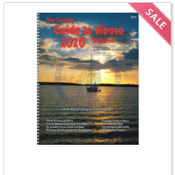
3 Things To Consider While You Do Nautical Chart Plotting


Sailing on a ship is a responsible mission to undertake. As a mariner, you have to be well-versed with the sea and the surroundings while you say. Regardless of the fact that your mission is domestic or international, you should have a comprehensive collection of nautical charts on your ship. You have to do the plotting on the chart which requires you to have the right information about all of them. Although there are a lot of things which you have to consider while plotting a chart, there are some basic details which you should be well-aware about.

Below is a list of things that you have to consider while plotting nautical charts-

1. The scale of the chart- The moment you open a nautical chart, you should look below at the lower part of the chart. It has details about the scale that is present and the way you have to use it. You can have a look at the latitude and the longitudinal divisions of the chart that is present. When you have an accurate idea of the scales, there are far fewer chances of committing an error.

2. Chart Symbols- The knowledge of chart symbols is crucial in the plotting of maps. The symbols that you encounter on the nautical chart are mostly familiar. However, if you come across new symbols which are used less often, then you should make a note of them. Keeping a trusted publication handy for reference will significantly minimize the chances of errors which might otherwise occur.

Nautical Charts

 3. Chart Notes- The notes of the chart cover information about the routes in those areas. You can navigate across that area by interpreting the chart notes. They are written around the place where the name of the chart is written. Information about fishing areas, anchor areas, and the naval exercise areas would all fall under the chart notes.

When you buy the nautical charts, make sure you are aware of all the information that is presented. Browse through the web to know more.

Overview of Raster Charts Used By Sailors and Boaters

When there is an electronic image of the familiar paper chart, obtained by the help of a highly accurate and detailed scanning process,...