Friday, May 10, 2019

How Dangerous Cargo Is Classified And What Is The IMDG Code?


The International Maritime Dangerous Goods or IMDG Code was adopted in 1965 as per the SOLAS (Safety for Life at Sea) Convention of 1960 under the IMO. The IMDG Code was formed to combat all types of pollutants at sea.

The IMDG code also ensures that the goods transported through seaways are packaged in such a way that they can be safely transported. The dangerous goods code is a uniform code. This means that the code is applicable to all cargo-carrying ships around the world.
IMDG Code

 IMDG CODE
The dangerous goods code was created as per the recommendations of the United Nations’ panel of experts on transportation of hazardous goods along with the IMO (International Maritime Organization), the central body of maritime law and intelligence. This proposal by the UN was presented as a report in the year 1956 after which the IMO IMDG Code was started to be drafted in the year 1961.

How Does The IMDG Code Contraband Dangerous Goods?
Shipping dangerous goods is a very complex business. Thus, to avoid complications or problems while categorizing the aspect and level of danger; there is a set of classification for dangerous goods. There are nine clauses in which the dangerous goods are classified. The hazardous goods labels and dangerous goods certificate for the cargo are issued as per the nine clauses which are constantly amended by the IMO.

3 Things To Consider While You Do Nautical Chart Plotting


Sailing on a ship is a responsible mission to undertake. As a mariner, you have to be well-versed with the sea and the surroundings while you say. Regardless of the fact that your mission is domestic or international, you should have a comprehensive collection of nautical charts on your ship. You have to do the plotting on the chart which requires you to have the right information about all of them. Although there are a lot of things which you have to consider while plotting a chart, there are some basic details which you should be well-aware about.

Below is a list of things that you have to consider while plotting nautical charts-

1. The scale of the chart- The moment you open a nautical chart, you should look below at the lower part of the chart. It has details about the scale that is present and the way you have to use it. You can have a look at the latitude and the longitudinal divisions of the chart that is present. When you have an accurate idea of the scales, there are far fewer chances of committing an error.

2. Chart Symbols- The knowledge of chart symbols is crucial in the plotting of maps. The symbols that you encounter on the nautical chart are mostly familiar. However, if you come across new symbols which are used less often, then you should make a note of them. Keeping a trusted publication handy for reference will significantly minimize the chances of errors which might otherwise occur.

Nautical Charts

 3. Chart Notes- The notes of the chart cover information about the routes in those areas. You can navigate across that area by interpreting the chart notes. They are written around the place where the name of the chart is written. Information about fishing areas, anchor areas, and the naval exercise areas would all fall under the chart notes.

When you buy the nautical charts, make sure you are aware of all the information that is presented. Browse through the web to know more.

Tuesday, April 9, 2019

CFR Code In Its Latest Edition For Maritime Law Experts


CFR 33 deals with nautical laws and is handy among sailors and Coast Guards. In fact, it is an important part of litigation, and knowing the CFR 33 will keep you up to speed with the laws of different waters. This is called admiral law or maritime law which deals with potential offenders such as trading ships and sailors of the Navy. It is an intricate part of public international law and some sections of the CFR 33 are highly relevant to trading and territorial disputes in the navigable waters of America.
 CFR 33 in the latest edition, is a book which should be bought by any enthusiast of the sea, and maritime law. Title 33 and Title 46 of the Code of Federal Regulations are usually consulted by Classification societies, engineering firms, deck officers on oceangoing vessels, and marine engineers. It covers jurisdiction, general provisions, the protection and security of vessels, harbors, and waterfront facilities.
Chapters Of The Book
The CFR 33 comes in its latest edition to keep you up-to-speed with current protocol on oil spills and trade disputes. What's more, it gives the code by which bridges can be built on territorial waters. You can determine the security of your vessels and sue trespassers on your vessel. This book governs the functions of oil and gas companies that may have large-scale processes, but, never fail to abide by the laws written in this book.
It is divided into three chapters:
  • Chapter I — United States Coast Guard,
  • Chapter II — Army Corps of Engineers,
  • Chapter IV — Saint Lawrence Seaway Development Corporation.

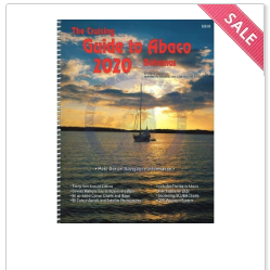
Why Cruising Guides Are Essential For A Voyage In Strange Waters


If you are planning a voyage in unfamiliar waters, you must know that there are a lot of dangers that lurk in strange waters. Apart from the amazing adventures that the oceans offer, the wild waves also poses immense risks that are beyond human control. This is the reason experienced owners and crew members of recreational vessels often consult with cruising guides when planning water voyages.
It is the knowledge of winds and currents that determine the position and maintaining direction of the vessel. The best laid navigational plans always include cruising guides, charts, and sailing directions as they help comprehend the vast stretches of ocean and coastline. From giving recommendations about specific paths, navigational hazards, and other obstacles of which all crew members should be aware, to offering color photographs, nautical charts and in-depth information about how to successfully navigate local waters, these guides have it all that is needed on a voyage in strange waters.
Also, a number of popular places to go and things to do are featured in the guide. Along with this, they usually contain information with regards to changes to major marine navigational routes and other potential hazards. Moreover, you will also be able to learn about hotels, restaurants, sporting events, and other attractions that are popular with visitors. Your voyage might take you to a port where the local customs are entirely different from your native place. A cruising guide can be consulted for information and guidance regarding the local customs of the port your voyage has landed you in.
One of the leading nautical services based in FL provide cruising guides, books, charts, instruments, signs, placards, and a number of other marine supplies.


Monday, March 11, 2019

Carry Solid Bulk Cargoes Safely With IMSBC Code Publications


The IMSBC Code, was first adopted on 4th December 2008. It joined the force officially on 1 January 2011, from where it became mandatory under SOLAS convention. As you know, the International Convention for the Safety of Life at Sea talks about the several aspects of maritime safety. Its sixth chapter discusses all the provisions that govern the carriage of solid bulk cargoes. 
 

                        imsbc Code
These provisions are furthered in the
IMSBC Code, which stands for International Maritime Solid Bulk Cargoes Code. This code is the substitute of the initial Code of Safe Practices for Solid Bulk Cargoes. Its focal aim is to minimize the dangers associated with particular kinds of shipments. It provides the information to seafarers about the instructions and procedures, which need to be considered to keep safe.
Some of the most common hazards related to shipment of solid bulk cargoes are structural damages, which happen as a result of improper cargo destruction, chemical reactions, or reduction of stability. Following the code strictly helps to harmonize the procedures as well as practices that need to be followed. It also guides you on the procedures when it comes to trimming, discharging, carriage, or loading of solid bulk cargoes when they are passed through the sea. They also ensure compliance with the provisions of SOLAS Convention.
There are various publications that provide all the information regarding the IMSBC code. If you are an administrator, shipowner, shipper, or master, these publications are just the right solution to understand the key requirements. They can give you a higher confidence, so that you can tackle all the risks with ease. So, wait no more and buy your guide today.


The International Protocol For Maritime Safety Of Commercial And Non-Commercial Vessels


Looking for the gear that will accentuate the safety measures on-board? Buying marine supplies might be the best route to ensure on-board safety. Emergency preparedness is important during any maritime emergency. Preparation tips are important when buying marine supplies. 
              Marine Supplies On-line
 You can buy marine supplies from on-line stores, there are a variety of stores that allow you to master safety on any kind of sailing vessel. Read further to know more about on-board safety through licensed ship radio stations.
International Protocol For Maritime Safety
The Global Maritime Distress and Safety System (GMDSS) is an internationally agreed-upon set of safety procedures, types of equipment, and communication protocols used to increase safety and make it easier to rescue distressed ships, boats and aircraft.
The system is intended to perform the following functions:
  • Alerting that includes position determination through coordinates
  • Search and rescue coordination
  • Locating through homing devices
  • Maritime safety information broadcasts
  • General communications
  • Bridge-to-bridge communications
How Are FCC Licenses Issued?
Specific radio carriage requirements depend upon the ship's area of operation, rather than its tonnage. Safety licenses that the FCC issues to radio operators and equipment maintainers allow to manage incoming SOS calls. Under the general guidance of the International Maritime Organization (IMO) to personnel involved in the Global Maritime Distress and Safety System (GMDSS), the FCC licenses are issued to candidates who pass a multiple-choice examination administered by FCC contractors drawn from question pools.

Tuesday, February 5, 2019

A Guide To Marine Signal Flags On Its Significance In The Marine World

There is an international code system when two ships decide to communicate with each other. This can also mean that a ship wants to signal the other in case of an emergency. These codes are nothing but nautical flags or marine signal flags. These flags can be used alone or in combinations with other flags.
Marine signal flags are made up of 26 square flags which are the various letters of the English alphabet along with 10 numbered pendants. Since flags can interact mostly at sea, for easy recognition, a combination of colors such as red and white, blue and white and, black and white are used. 

  Since these flags are used to communicate so, it is essential to have knowledge on the various flags and their signals.
1. One-flag signals are used for as an urgent signal
2. Two-flag signals are used at times of distress and maneuvering.
3. Three flags are used for point of the compass, standard times, and also general code and decode signals.
4. Four-flag signals are used as geographical signals.
5. The five flags are used to relate time and position.
6. Six and seven flags are used to indicate latitude and longitude directions.
Few international meaning for marine signal flags:
* A: Alpha - Diver down; keep clear
* B: Bravo - Carrying dangerous cargo
* C: Charlie - Yes
* I: India - I am altering course to port
* O: Oscar - Man overboard
* Z: Zulu – I require a tug
In case you are interested to purchase these flags as a hobbyist collector or to use it on a ship, there are a few on-line stores which can cater to your needs. These stores can also provide you information on the marine industry.

Overview of Raster Charts Used By Sailors and Boaters

When there is an electronic image of the familiar paper chart, obtained by the help of a highly accurate and detailed scanning process,...