Friday, May 1, 2020

Overview of Raster Charts Used By Sailors and Boaters


When there is an electronic image of the familiar paper chart, obtained by the help of a highly accurate and detailed scanning process, they are termed raster charts. A significant number of sailors and boaters are using chart plotters or chart navigation apps on their smartphones these days, which makes these charts quite popular. They come with exactly the same amount of information/data as the paper chart. Depending on the software or application that an individual is using, these charts may even come equipped with the same NOAA chart number. Virtually all navigation programs connect to different charts together, but that is done in a seamless manner. The electronic version, and in several other programs, there is the option of zooming, that can be useful in providing more more detailed information for that particular area.

The advantages of these charts are listed below.

l  All paper chart info can be retained, including details of the depth sounding, buoy number as well as any other available specific description. You may also find land features such as names of streets bordering the water.
l  Because raster charts can accurately match with the paper charts, it is easier to work underway to work between the wide view of large and small paper charts.
l  No learning curve is present for mariners who are already familiar with paper charts.

If you need to choose between raster and vector charts, it is purely a matter of personal taste, since both are equally accurate and reliable when it comes to electronic navigation.
Thursday, April 30, 2020

What Is The Purpose Of Cruise Guides?


If you are into the cruising business, then you must be aware of the cruising guides that experienced owners and crew members of recreational vessels often consult. Well, cruising in the middle of the sea is no joke and must be taken seriously. You never know when some unforeseen problems might occur and put the safety of passengers at risk. God forbid, if such a situation occurs, the crew must have in-depth information about the potential problems and the required solutions to fix them. For instance, if the ship is hit by a storm, then the crew must be able to handle the situation and make sure of the safety of the passengers at any cost.

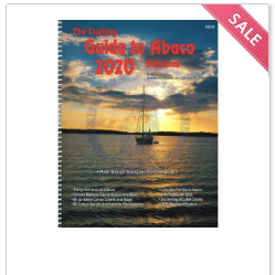
Although most of the cruise ships are able to outrun the storms, if a hurricane or storm is detected along the cruise route, the captain and the crew chart a new path and make modifications to the itinerary to keep the passenger safe. In order to be able to do so, they are well-versed with the cruising guides that give information about specific paths, navigational hazards, and other obstacles that the ship might encounter. These guides contain detailed navigational information about various cruise destinations including intercoastal Waterway of the U.S. Eastern Seaboard, Abaco, Hawaiian Islands, the Leeward Islands of the Caribbean, the Windward Islands of the Caribbean, Trinidad, Tobago, and Barbados among others. Cruise guides also include a lot of other information regarding hotels, restaurants, sporting events, and other attractions that passengers can look for in case there are any changes in the itinerary. The main reason why cruise guides are considered as important is that they prepare the crew and passengers to meet and overcome any sort of challenges that are thrown in their way and also to help them make quick decisions in case of emergencies. With many nautical cruising guides available online, you can look for the one that serves your requirements and gives you enough information about the place you are visiting.  

Thursday, April 2, 2020

What Are International Maritime Signal Flags?


Have you ever wondered why certain ships are dressed overall with different colored flags? Well, those are not just any flags. They are called international maritime signal flags and are widely used at seas for communication between ships. They can be used individually as well as in combination with other flags to convey various messages. For instance, consider the Zulu flag, which has the appearance of a diagonally quartered square and is filled with four different colors—yellow, blue, red, and black. It is also known as the Z flag and represents the letter Z in the English alphabet. When it is used alone, it means “I require a tug” but when used near fish vessels, it means “I am shooting nets”. Many a time, it is also used in combination with number flags to convey time; where the first two letters denote hours and the last two letters denote minutes. Apart from this, there are 25 letter flags such as Sierra, Alfa, and Mike that are also used to convey important information. 

These are usually built on sturdy white canvas with the use of strong and dark colors to make sure they do not fade away while the ship is at sea. Considering the fact that only certain colors are readily distinguishable at the sea, the signal flags are made by using just 5 colors— Red, Blue, Yellow, Black, and White. Of all the patterns and colors that are used for these maritime signal flags, interestingly, the Zulu flag is the only flag in the set that uses four different colors. It also happens to have special significance in Japan because of the Battle of Tsushima, which was an important naval battle, fought during the Russo-Japanese War. These flags are incredibly useful to the sailors who have depended on these signals for communication for multiple decades now.   


Chronometer - An Essential Tool In Marine


Always known for showing Greenwich Mean Time (GMT), chronometer is an instrument that is kept on ships to keep an accurate time.

The chief use of a chronometer on the ship is for the purpose of Astro-Navigation. In this, natural element Sun is mainly used. The sun’s altitude alters rather quickly. If an error of even four seconds is made then you are talking about an error of one nautical mile in the observed position.

For keeping a ship’s routine in check, accurate time is of utmost importance. This is where chronometer comes in, which helps in maintaining ship’s routine with its immaculate accuracy. As of now, it is the GPS system that is employed for both the purposes. But still, if a need arise for an alternative method, then a chronometer always come to the rescue. The codeof federal regulations have some guidelines for marine to follow. Those guidelines also stress on keeping the ship’s routine always in check.

Types

There is the spring tension chronometer and the electronic quartz crystal chronometer. The former uses a balance wheel and for regulation, a spiral spring instead of a pendulum.

The latter is a clock that constitutes of an electric oscillator. In this, a quartz crystal is present that regulates the oscillator to maintain the correct time. This oscillator is known for producing a signal with super accurate frequency which translates into quartz clocking magnitude a lot more precise than the mechanical clocks

Monday, March 9, 2020

Meaning of the Letters of International Maritime Signal Flags

International maritime signal flags are a variety of flags that are highly effective in communicating with ships. The principal flag systems and related codes comes under the International Code of Signals.Various navy authoritiesuse flag systems with additional codes and flags, and other few type of flags are utilized in special scenarios, or have some kind of historical significance.

There are numerous methods by which the flags are used as signals. The methods are listed below.

1.  A range of flags can be used to spell out a message, with each flag representing a letter.example is the Bravo flag, which is letter B.

2.Individual flags come with standard and particular meanings.

3.  Multiple flags can be used at the same time that can form a code word whose meaning can be looked up in a guideline book held by the concerned parties. 

4. In yacht racing, flag meanings change, for instance the letter P flag is used as a ‘preparatory’ flag to mean an imminent start, while the letter S flag means ‘shortened course.’

Some of the international maritime letter flags are mentioned below along with the meaning.

1.  A - Diver below (when stationary) and I am undergoing a speed trial
2.  B - I am taking on or discharging explosives
3.  C - Affirmative
4. D - Keep clear off me
5.  G - I require a pilot
6.  H - I have a pilot on board
7- I am altering my course to port
8.  Y - I am carrying mails
9. Z - to be used to address or call shore stations

Consider this blog post and make use of Bravo Flags or other letter flags.


What You Must Pack For a Sea Voyage

You are one of those people who leave homes to seek solemnity somewhere in the corner of the earth. Visiting a beautiful place by aircraft and car might be familiar to you. However, a voyage is an extraordinary activity in terms of fun and adventure. If you are planning a journey to the land beyond the sea, don’t forget to pack all the necessary things like NOAA charts. The best way to remember the items is to write them down in a diary. Among other things, here are some essentials you should pack for safe travel.

Knife

No, you are not going to present a chef’s skills in the middle of the sea. However, it is important for sailors to take a cutting tool or two. When you are out in the wide-open water, you are exposed to several hostile elements such as pirates and dangerous sea creatures. The knife can be a useful weapon if you come across such an element on your way. Other than monsters, you can use the knife and have a nice meal if a delicious fish shows up.

Extra items

Unlike a road trip, you cannot hitchhike a motorist when your vessel breaks down in the sea. Even if there is no such risk, you must take all the things that will benefit you in the journey. They may include first aid kits, a notebook, diary, rope, camera, binocular, hat, goggles, and water containers.

Map

You must never travel without a map. The diagrammatic representation of specific regions will be your best companion when you see guidance to the right path. Buy necessary marine tools and equipment such as NOAA charts, maritime books, nautical instruments, and flags from a certified store.

Pack all the small things in your backpack so that you can easily assess them in case of emergencies. Record most of the beautiful moments in your camera and share your story on social media.


Friday, February 7, 2020

Guide To Making Cargo Operation On Oil Tankers Safer

Crude oil and most petroleum products are transported through sea voyage on oil tanker ships. These liquid substances are extremely hazardous. They are flammable as well as toxic to the human body. This is why operations of these vessels on broad water require special directives for safety and legal issues. If you are managing an oil cargo business, get a copy of ISGOTT.

get a copy of ISGOTT

Purpose of ISGOTT

The International Safety Guide for Oil Tankers and Terminals was first published in 1978 by  the International Chamber of Shipping (ICS), and the ‘International Oil Tanker and Terminal Safety Guide’, by the Oil Companies International Marine Forum (OCIMF). It was reviewed and the fifth edition was published in 2006 to ensure that it continues to reflect current best practices and legislation.

For a safe journey till the destination, crew members involved in the operation must know all the essential guidelines as a part of their duties. 

  • Close the doors

Carrying crude oil can increase temperature and humidity in the accommodations. This might trigger some people on the board to get some fresh air. As per the safety rule, they must close all the openings because the fume of oil can result in an explosion.

  • Shut natural ventilation

It is pleasant to take natural air while traveling on the water. However, such a practice is risky because the air can take the vapor outside the room. This may result in polluting the atmosphere of the vessel’s path. Even if someone opens a window for a short time, he must close it again before continuing daily chores.
  •  Shut cargo tank lid

When the ship sails on the rough water, there may be lots of shaking. An open lid of the oil tanker can spill the liquid overboard. An oil spill is toxic to natural habitat in the ocean. It can also catch fire in the areas where there are drops of oil.

Besides taking care of the oil tanker as per the guidelines of ISGOTT, workers also wear safety gear. They must avoid smoking and using static electricity charge in the tank.

Overview of Raster Charts Used By Sailors and Boaters

When there is an electronic image of the familiar paper chart, obtained by the help of a highly accurate and detailed scanning process,...